Wednesday, July 24, 2013
Across Oregon in One Day (Day Twenty-five)
Wednesday, July 17, 2013
Down and Out in Idaho Country (Day Twenty-four)
After a long sleep in the home of our unexpected new friends, we bid farewell and rode into downtown McCall. Breakfast and groceries later, we began our day by heading west out of town on highway 55.
Despite our varied experiences and accumulated fatigue over the past three weeks, this next section of highway was a real thriller! Steep downhill of winding curves, the highway signs warned motorized traffic not to exceed 25 mph in many sections. Nearly keeping pace with other traffic, we (almost) literally screamed into New Meadows.
Skimming down the straight main street, touring cycles were spotted outside a cafe. Soon we had found their owners within and ordered the best malts of the trip. The middle-aged couple had come from the Hells Canyon direction, and were considering riding to McCall. We strongly recommended NOT riding into McCall from the west due to the steep, narrow, winding uphill (and stand by this recommendation, unless motorized traffic manages to be absent). After a conversation mostly about their sailboat, we were on our way.
Next we rode our bikes. And kept riding. Small hills were challenges. The slight headwind was maddening. Yes, limits were being reached... For twenty-two of the past twenty-three days we'd pounded cleat to pedal, major muscles burning untold calories. Would we ever make it back to Portland, or even to Oregon?
Searching for a shady lunch rest stop, we ended up in a wooded flat spot near the crest of a hill. Here the highway cut through National Forest, and here, due to steep hillsides and guard rails, no car could stop. Lunching and munching, Kevin heard a crunching... bear! Quickly standing, we watched as the black bear crossed the road towards us and with admirable speed scrambled up the adjacent steep, brushy hillside. Popping up over the guard rail on the opposite side of the road, she was probably accustomed to waiting for gaps in traffic, but not to finding random cycle tourists.
Cresting one more hill and leaving National Forest behind, we flew down into farm country and eventually landed in the town of Council. Sitting in a patch of thick grass graced with evening sun, and with access to the interweb once again, we informed our vague notions with cold facts. Where could we catch a bus west? Amtrak, greyhound, local line? From Ontario, Baker City? Would bikes need to be boxed? Many questions still unanswered, we fell on the more immediate issue of the lateness of the day. Could we camp along the Weiser River Trail? Should we try to catch a ride into Ontario, where morning buses depart from?
Tired and still with no clear direction, we decided to take the easy, simple route- a box (motel), but with a caveat. With the maximum price we were willing to pay set at $40, we walked into the Starlite Motel. $45 for a room we were told. Maybe our resolve was evident, because soon we were made a second offer- $40. Satisfied, we scurried into the pre-made shelter to watch the brush and grass-covered hills turn pink and windy in the twilight.
Unexpected Hot Showers (Day Twenty-three)
The sun warmed us amongst the tall Ponderosa. Almost done packing we were greeted by the camp host who reminded us of the mysterious hot springs shower. "If you don't walk in the river you're not there," he explained. Our gear was packed in minutes.
The well worn trail skirted along the Payette leading to a high pool on a rounded escarpment. We soaked in the shallow pool admiring red, green, and black biofilm before heading towards the shower. A submerged causeway of stone led between the cliff face and a large eddy in the turquoise river. We waded through the icy waters to another sandy beach. The great rock face above us exuded red and black snot that hung down in long strands. Rivulets of geothermal water ran over the shining stone. Below, the small slope of river deposit had been organized into a few cascading pools fed by a 20 foot waterfall of steaming liquid. We alternated roasting in the waterfall and cooling off in the gentle eddy. Thoroughly relaxed we returned to our metal steeds and powered up the hill.
The Banks-Lowman road continued high above the river. Soon the forested hillside gave way to rocky cliffs and we dropped along the canyon walls. Out of the protective shade the sun's rays baked us as we rode on to Garden Valley. We found the Garden Valley Market and quickly dominated a cafe table with our mountain of food. Finally we ate the 5-serving tuna can found in Montana by way of taco buffet. We conquered a bag of cheetos and wrote. Eventually it was time to brave the heat again and finish the descent to Banks.
We were met at the crowded intersection with an exodus from the North towards Boise. Relief from the heat was close at hand in the North fork of the Salmon. The cooling refreshment spurred to try and hitch North to McCall with such heavy traffic. We positioned ourselves in a nearby gravel lot and stuck our thumbs out. Soon enough a red van approached us and we met Toni, her dog Bo, and a blind bobcat named Woody. Toni, a wildlife rehabilitation specialist, graciously drove us to McCall and insisted on dinner on the town with her husband Rich. We happily fell asleep on a spare bed in a delightful food coma.
Sunday, July 14, 2013
Stanley, ID and Banner Pass (Day Twenty-two)
Camped only a few miles from Stanley, we decided to wake early and have breakfast in town. The sun was just beginning to find its way into the shallow river canyon as we made our start. Not waiting for warmth and light to find us and melt the frost from the outside of our sleeping bags, we set out on the nearly empty and still road. A few more miles following the Salmon upstream, and we entered Stanley, a small town with the grey, jagged teeth of the Sawtooth Mts. creating a dramatic backdrop for the high-elevation valley.
We rode circles around the town- deciding which of the cafes might have the best breakfast, restocking at the small mercantile, visiting tourist info for tips on road conditions, checking the gear shop for Da Brim (Hank had this fabulous helmet-specific hat as we rode north from Jackson, MT), and a final ice cream stop before heading west out of town towards the Sawtooths.
Assured that the wind from the west would cease as we left the valley, we pedaled out with optimism. Barely stopping, we powered our mechanized vehicles more than 20 miles to the top of Banner Pass. While not completely headwind-free, trees (their abundant presence long-missed) helped break the wind. At the top we stopped for a break in the shade, swatted at a few giant biting flies, and suffered comments from speedier two-wheeled vehicles (motorcycles).
Launching from the top of the pass, we dropped quickly and then joined the Payette River in its more gradual descent. Glimpsing the turquoise liquid shining and twisting, we took the first opportunity to dunk ourselves and wash off the heat.
Continuing to Lowman, the store/cafe stop we had been talking did not appear so we continued following the Payette west. Several miles later we eyed a riverside gravel pull-out and were considering its campsite potential when suddenly a large black pick-up pulled from behind the tall hill guarding the gravel road. Spooked, I was sure I'd seen this pick-up pass us at least twice today. But after quick chat we learned that this was National Forest land, that he was hunting rocks, and that there was a campground just up the road, with hotsprings at that.
Pine Flats campground appeared as a descent to the left. Swooping and switchbacking, we pulled into the large, populated campground. One ride around the loop told us there was no vacancy. Considering our options, we walked down to the river's edge. We could stealth camp, or meet people who would share their campsite with us. We could not ride the hill back up to the road tonight, and we needed to eat dinner right now. Cooking over our tiny alcohol stove near the trailhead to the hot springs, the camp host came over to enforce fire safety and let us know that while the people in 6 had also reserved 7, it was not being used.
Dinner consumed, we went to ask if we might occupy the unused campsite. Yes, of course! They said. Oh, but that was 8... over to 6 and another affirmative, along with a campfire invitation. Necessity is the mother of invention, but perhaps also of friendship... soon we were sharing a campfire with people from a company (Coldchain) that makes energy-efficient, bullet-proof freezer doors about to raft the Payette river. Learning more about the Payette river, morel mushrooms, and south African animals than we could have dreamed, we eventually headed back to our own spot under the star-spattered sky and fell asleep.
Ghost Springs and Hot Towns (Day Twenty-one)
Cloud cover blown off in the night, it promised to be another hot day. Our conversations the previous day tipped us off to the nearby mining town of Bayhorse, a remote canyon settlement built on lead, silver, and gold. The boom town busted like many due to harsh winters, high transportation costs, and dwindling lodes.
After a short mile from the campsite we turned onto an old wood and steel bridge. A sign warns visitors they will find no potable water along the crystal clear creek running through distant tailing piles. We stashed our gear and proceeded unencumbered. A well worn gravel road pushes its way through the steep valley and dry forests. Reaching out of the foothills we catch a glimpse of the rough valley. Dramatic cliffs of granite and shale riddled with caves dominate the sky. A thin layer of the biosphere clings to the rocky slopes and holds the impossible angles where undisturbed.
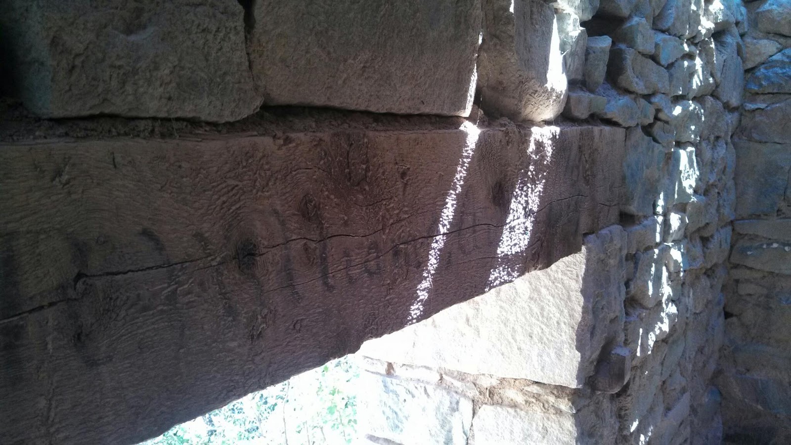
Despite climbing in elevation the heat of the day mounted on the exposed gravel trail. Finally we could see the roof of a mill in the distance and knew the river of rock would end. A well preserved stone hut dug into a hill caught our attention and we momentarily escaped the heat to explore. The low head beam bore an inscription in faded charcoal barely legible, though "1886" stood out.
A few hundred more feet and we reached the sizzling asphalt of the visitors parking lot. Bayhorse proved to be more developed than we had thought. It turns out the site was "parkified" in 2005 as part of a greater effort to manage the toxic mine wastes. Visitors are restricted to fenced paths and warned to wash their hands before eating or drinking. All of the structures sport warnings of waste contamination. Thousands of tons of lead were mined and concentrated here. We had to remind ourselves of this as tempting currants hung over the railings.
A curious mixture of 19th and 20th century machinery was strewn about the site. Some buildings look to have been occupied fairly recently, creating an eerie feeling of anachronism. One particular house was especially foreboding yet beckoned with magnetic charge. This one was one of the longest continually inhabited structures in Bayhorse, built by the town physician. Walls cracked and second story held up by raw timbers, the house clearly had stories to tell. A noose hanging from the foyer rafters was enough to end the exploration.
The suffocating heat back at the tarmac was too much for us and we escaped before becoming Rip van Winkle'd in the spook zone. We flew down the rough gravel amazed at the amount of elevation gained earlier. Dropping back onto the main road we were met with the stiff headwind pouring in from the South.
Along the meandering pavement, led by the river in reverse, we continued our geology lesson. The ancient river gorge cut through decaying columnar basalt flipped and folded. Batholithic granites broken long ago now filled with wide quartz deposits. Great masses of sandstone and shale lifted from long gone seas.
The persistent headwinds and broiling thermal onslaught drained our energy. Yet in each refuge we found the citizens clued us in to hot springs along our route. Miles passed and we gained more details, crystallizing the location of the springs. As the sun fell the winds dropped off and we reached top speeds. Finally Sunbeam hot springs came into view.
Steam billowed off the geothermal water pouring out of the highway-side culvert and mingled with river water amongst boulders. The riverside hillside is covered in red biofilm. We searched for an unoccupied pool, eventually settling in next to some cool cats. As soon as we mentioned our Oregon origins Sherri and Mike asked if we would pass through Bend, our intended Cascade crossing. They graciously offered their house if we needed a break. We soaked in the steaming sulfur springs glad to have made it.
Muscles relaxed we travelled the final miles to the Mormon Bend campground, enjoyed another taco buffet, and laid our heads to rest under the twinkling Milky Way.